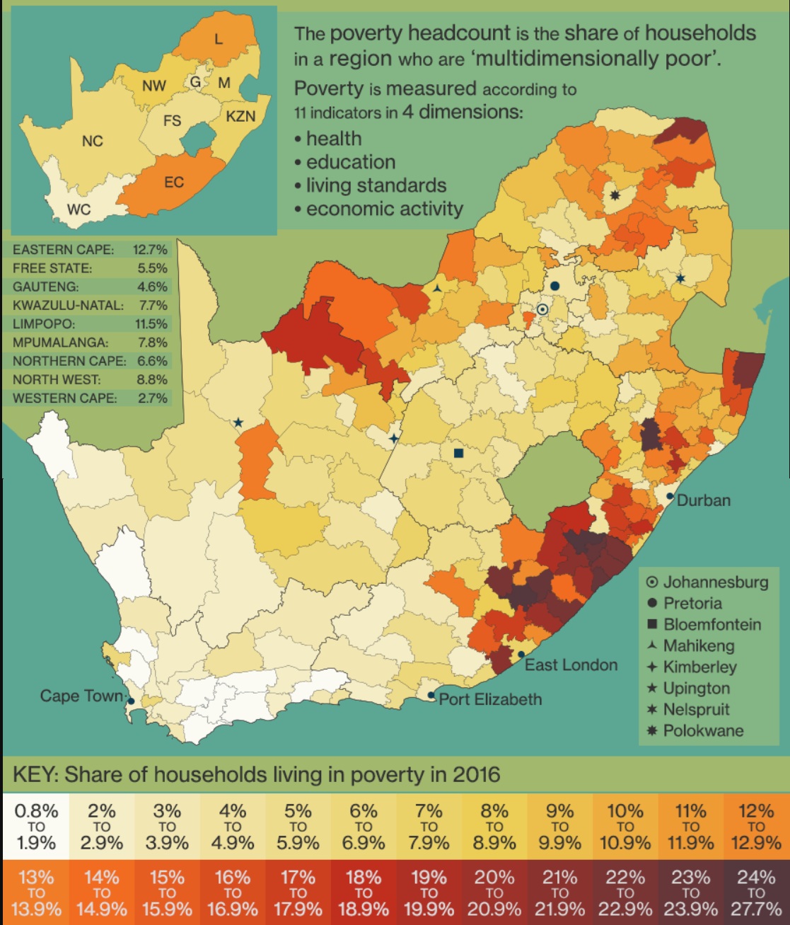
The first map shows the percentage of households living in poverty in each municipality, based on data from the Statistics South Africa Community Survey 2016. It highlights the stark economic disparities across the nation.
The second map reveals South Africa's former homelands - regions established during apartheid to segregate black South Africans. These include Transkei, Ciskei, Bophuthatswana, and others. These areas continue to face underdevelopment, limited infrastructure, and inadequate water services.
Even today, the spatial patterns of poverty and water deprivation in South Africa largely overlap with these historical homelands. The legacies of apartheid-era planning have resulted in persistent inequalities, where people in former homelands still face lower water security and access than urban or formerly white-designated areas.